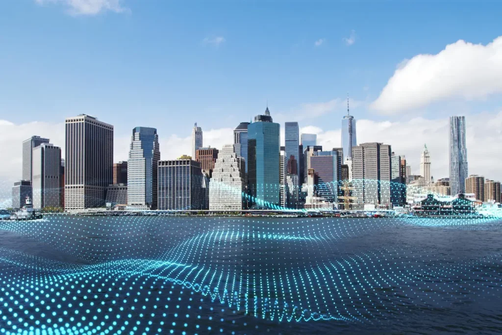
Digital Twin of a City: the key to smarter urban management
Cities are evolving at a frenetic pace. With population growth, pressure on resources and the need to optimize urban infrastructure, digital twins have gone from being a futuristic innovation to an essential tool. It’s not just a matter of technology: it’s a new way of understanding and managing cities, making every decision based on accurate data rather than assumptions.
Thanks to technologies such as geospatial artificial intelligence (GeoIA), the Internet of Things (IoT) and real-time data analysis, digital twins make it possible to simulate and forecast scenarios in areas as diverse as traffic, water management, energy efficiency or even resilience to natural disasters. And best of all: they do not remain theoretical, but facilitate strategic decision-making based on real information.
What is a digital twin and why is it on everyone’s lips?
Imagine you have a virtual version of your city that is updated in real time. That’s a digital twin: a dynamic digital replica of a city or some of its components. It’s not just a pretty 3D image, but a living, connected model that collects data on traffic, energy consumption, air quality, infrastructure and much more.
With this tool, administrations and companies can anticipate problems and make better decisions. An impending traffic jam? Traffic flows can be redirected. An area at risk of flooding? Preventive measures can be activated. The key is to turn data into solutions before problems occur.
Importance of a digital twin in cities
Until recently, urban management was based on static, often outdated data. But now, with digital twins, cities can react in real time. Some of the clear advantages include:
- More efficient mobility: Analyzing traffic flows makes it possible to adjust traffic lights, improve transportation routes and reduce traffic jams.
- Optimization of energy consumption: Buildings with high energy consumption can be detected and efficiency solutions can be proposed.
- Improved urban planning: Areas with a deficit of green spaces or with potential for new infrastructure are identified.
- CO₂ emissions reduction: Green areas can be strategically managed to act as carbon sinks.
- Emergency resilience: From fires to floods, digital twins allow you to simulate crisis scenarios and prepare effective responses.
In short, digital twins not only improve the efficiency of the city, but also make it more livable and sustainable.
Spanish cities that already have a digital twin
In Spain, several cities are already betting heavily on this technology. Here are some examples:
Barcelona: It has been one of the first to develop a digital twin to optimize its infrastructure, improve mobility and reduce energy consumption.
Madrid: It is using a digital model to make its transport network more efficient, avoiding bottlenecks and improving planning.
Valencia: Has integrated digital twin technology for air quality control and water management.
Malaga: It has gone a step further with GeoIAusing geospatial data to improve sustainability and climate resilience.
Each of these cities is exploring different applications, but all have a common goal: to become smarter, more sustainable and efficient environments.
How to create a digital twin of a City?
Building a digital city twin is not as complicated as it seems. However, it is necessary to follow a series of key steps to make it functional and provide real value.
Collect data
Without data, there is no digital twin. For the model to work, it is necessary to collect information from multiple sources:
- IoT sensors in streets and infrastructures.
- Satellite imagery and geospatial data.
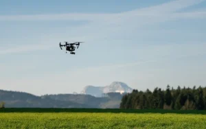
- Information captured by drones.
- History of energy consumption, traffic and air quality.
The more accurate and up-to-date the information, the more useful the digital model will be.
Integrating information
Once we have the data, the complex part comes: making sense of it. It is not enough to accumulate information; it must be processed and organized in a digital platform.
For this purpose, tools such as:
- Big Data and cloud analytics to process huge volumes of information.
- Geographic Information Systems (GIS) to represent the city on interactive maps.
- Artificial Intelligence to detect patterns and predict scenarios.
Only when all this information is integrated can the digital twin begin to deliver real value.
Connect the model to its physical twin
A digital twin is not just a pretty mockup. It must be synchronized with the city in real time to reflect changes and become a dynamic tool.
For example, if a city wants to improve water management, the digital twin can be connected to sensors in the supply network. Thus, if a leak appears, it is detected instantly and action is taken before there are significant losses.
The same applies to traffic, energy consumption and any other urban parameter. The key is to make the digital model and the real city work as one system.
Start-up
Once the model is operational, the possibilities are enormous:
- Intelligent mobility: Simulation of scenarios to optimize transportation routes and avoid traffic jams.
- Urban sustainability: CO₂ emissions control and strategic green space planning.
- Infrastructure and energy: Monitoring of energy consumption to reduce unnecessary spending.
- Water management: Optimization of water resources and detection of leaks in the network.
- Emergency preparedness: Simulation of natural disasters to improve crisis response.
With all this information, cities can make smarter, faster, data-driven decisions.
The future of urban management is already here
Digital twins are here to stay. They are no longer a laboratory experiment or a promise for the future: they are a real tool that is transforming the way cities are managed.
As this technology evolves, its impact will be even greater. Soon we will see digital twins with even more accurate predictive models, integrated with advanced artificial intelligence and capable of simulating any urban scenario.
The future is not only digital, it’s smart. And the cities that know how to take advantage of it will be the ones that make the difference.
Want to implement geospatial technology in your city? Find out how Agforest is using GeoIA to transform urban management. Let’s talk.