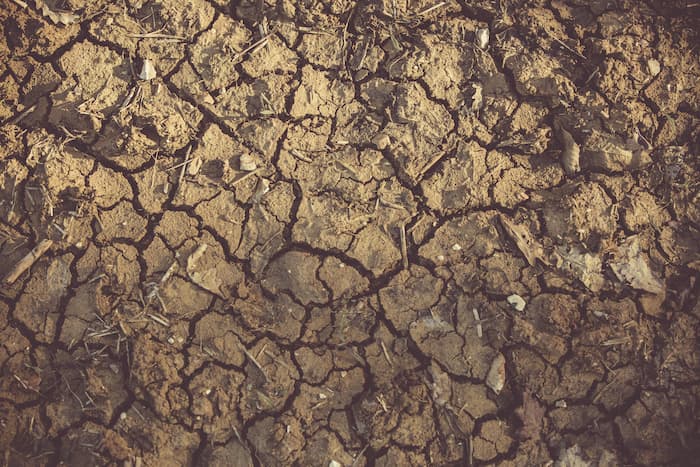
Agricultural soil erosion
Have you ever wondered why topsoil seems to fade over time? The answer lies in a natural phenomenon and, in many cases, accelerated by human activity: soil erosion.
What is soil erosion?
Soil erosion is the degradation of terrestrial soil through the action of natural factors, such as wind or water, and by human action.
This phenomenon can have significant consequences on soil quality, affecting fertility and water retention capacity.
In addition, soil erosion can also lead to ecosystem degradation, loss of biodiversity and sedimentation of nearby water bodies.
Types of erosion
There are several types of soil erosion, each under specific conditions and with distinctive characteristics.
Some of the most relevant ones are discussed below:
Water Erosion
It is produced by the impact of raindrops and water flow on the soil surface. It can be divided into two subtypes:
- Laminar erosion, which is a uniform loss of a thin layer of soil.
- Erosion in furrows, where deeper channels are formed.
Wind erosion
Caused by wind transporting soil particles. This type of erosion is more common in arid or semi-arid areas, where vegetation is scarce and the topsoil is more susceptible to being displaced by the wind.
Glacial Erosion
Glaciers, masses of moving ice, can also contribute to soil erosion. As they move, glaciers can uproot rock fragments and soil, modifying the landscape in their wake.
Gravitational Erosion
This type of erosion involves the descent of loose materials down a slope due to gravity. Landslides, rock falls and avalanches are examples of processes associated with this type of erosion.
Biological erosion
Biological activities, such as plant roots and the action of microorganisms, can also contribute to soil erosion. Although it is usually a slower process, in the long term it can have significant impacts.
Anthropogenic Erosion
Human activity, such as deforestation, intensive agriculture and construction, can dramatically accelerate soil erosion. Removal of vegetation cover and landscape disturbance increase the vulnerability of soil to water and wind erosion.
Soil phases: erosion process
The process of soil erosion consists of several phases that illustrate how this phenomenon develops and progresses.
1) Detachment
The first phase involves the separation of individual soil particles from the surface layer. This may occur due to raindrop impact, wind action, biological activity or gravitational influence. At this stage, the loose particles are prone to being washed away by erosive agents.
2) Transportation
When soil particles break loose, the transport phase begins. Rainwater, wind, glaciers or other transport agents carry the loose particles with them to new locations. The speed and distance of transport depends on the intensity of the erosive agent involved.
3) Deposit
When the velocity of the transporting agent decreases, either due to decreased rainfall, loss of wind force, or glacier melt, soil particles are deposited in a new location. This sedimentation process can occur in rivers, lakes, deltas, or other areas where water or wind velocity is reduced.
Erosive agents
Erosive agents are the elements responsible for triggering the soil erosion process. Here, we will detail the main types of erosive agents, highlighting their characteristics and modes of action:
- Water:
- Rain: Raindrops can hit the soil surface, dislodging particles and creating ruts in the topsoil.
- Surface runoff: Water that accumulates in excess can form streams that wash away soil particles, causing water erosion.
- Wind:
- Wind picks up and transports soil particles, especially in areas with little vegetation that does not retain soil.
- Glaciers:
- The movement of glaciers drags with them rocks and soil, modifying the landscape as they advance.
- Gravity:
- The force of gravity causes the downward displacement of loose material, resulting in landslides and rock falls.
- Biological Activity:
- Plant roots: Roots can destabilize topsoil, especially under conditions of deforestation or ecosystem degradation.
- Microorganisms: Some organisms, such as bacteria and fungi, can contribute to soil decomposition and soil erosion over time.
- Human Activity:
- Deforestation: The massive removal of trees reduces the soil’s capacity to retain water and increases its vulnerability to erosion.
- Intensive agriculture: Agricultural practices such as excessive plowing and lack of vegetation cover increase soil susceptibility to erosion.
- Construction: Disturbance of the urban landscape can trigger soil erosion, especially when natural vegetation is removed.
Preventing erosion with geospatial analysis
Soil conservation and erosion prevention are two important aspects of maintaining the health of our ecosystems.
In this context, geospatial analysis is a useful tool, providing detailed information about the terrain and enabling more effective land management strategies.
Using technologies such as satellite imagery and drones, geospatial analysis can identify areas prone to erosion. Detailed topographic data and elevation models reveal terrain features that can increase the risk of erosion, such as steep slopes or lack of vegetation cover.
In addition, geospatial analysis facilitates the monitoring of changes in land use, such as deforestation or agricultural expansion. This constant monitoring helps to anticipate and address practices that could increase soil vulnerability to erosion.
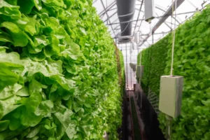
Another relevant aspect is land cover planning. Using data on vegetation types, health and distribution, geospatial analysis helps to design effective planting and vegetation restoration strategies. Vegetation acts as a natural barrier against erosion by stabilizing the soil with its roots.
In the field of water management, geospatial analysis can help assess runoff patterns and direct water management more efficiently. The construction of terraces, ditches and reservoirs in strategic areas can reduce water flow and minimize the risk of erosion.
Also, by analyzing data on agricultural practices, such as crop types and tillage methods, more sustainable approaches can be identified. Geospatial analysis can be guided by crop rotation, use of cover crops and soil conservation techniques.
Finally, through visual representations and maps, geospatial analysis facilitates education and awareness of soil erosion. Data visualization can be a powerful tool for communicating the importance of sustainable practices and soil preservation.