Asbestos remote sensing: automated census with ia
We manage the presence of asbestos in buildings and structures, so we will explain in depth the way in which we manage it in order to explain a little more about our service. We explain below how it is possible to detect the presence of this dangerous mineral without the need for intrusive interventions.
What is asbestos and why is it important to detect it?
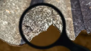
Asbestos, or asbestos, is a group of naturally occurring fibrous minerals that have been widely used in various industries due to their unique properties, such as heat resistance, electrical insulation and durability. It has been used in the manufacture of products such as building materials, automotive components, textiles, chemicals and more.
However, asbestos presents serious health risks, which led to its ban. When asbestos fibers are released and become inhalable, they can enter the lungs and cause significant damage over time. That is why it is important to detect and manage it properly. Asbestos detection involves identifying the presence and concentration of asbestos fibers in the air, in materials and in the general environment.
Law 7/2022, of April 8, on waste and contaminated soils for a circular economy, requires municipalities to draw up a census of facilities and sites with asbestos, including a timetable for their removal.
What is satellite remote sensing?
This type of remote sensing is a technology that allows the acquisition of information about the Earth and its features through orbiting satellites. It uses sensors installed on these satellites to capture electromagnetic radiation, such as visible and infrared light, emitted or reflected by the Earth’s surface. The information collected is processed and analyzed to obtain data on aspects such as vegetation, climate, topography, water quality and changes in land use, among others.
It has a great capacity to provide large-scale, near real-time information, which is essential in applications such as environmental monitoring, natural disaster management, precision agriculture, urban planning and natural resource surveillance. Satellite remote sensing provides a detailed, global perspective of our planet, facilitating informed decision-making in a variety of fields.
What is asbestos remote sensing?
Asbestos remote sensing is a technique that uses very high spatial resolution (VHR) satellite imagery to detect the presence of asbestos in buildings and structures. Asbestos, known for its health risks, has long been a challenge in terms of detection and monitoring. However, thanks to remote sensing, we can now geolocate asbestos roofs without the need to physically access the structures.
Thanks to the use of satellite images we can identify the presence of asbestos in buildings and structures and keep track of this in real time. Its functionality is the life cycle management of census, schedule and removal of asbestos.
How the detection of this type of material works
This technique makes it possible to detect asbestos roofing in the open air without the need for physical inspection or direct contact with the material, which makes it particularly useful for the creation of a localized asbestos census in urban and rural environments. It also provides information on the size and shape of the asbestos-containing roofing, which facilitates its management and removal.
Thanks to this technology, a recall can be planned more efficiently and economically and comply with government and safety regulations.
Agforest: Leaders in asbestos remote detection
Agforest stands out as a leader in the implementation of asbestos remote sensing. Their focus on the use of cutting-edge technology, combined with years of experience in the field, allows them to provide a reliable and efficient service. From asbestos lifecycle management to asbestos removal planning, Agforest is positioned as a one-stop solution for asbestos-related concerns in buildings and structures.
Contact us now and you will get an answer in less than 24 hours.