

With questions about CO2 absorption maps? Below we will explain everything about this tool, backed by geospatial technology, it is revolutionizing the way we understand and manage carbon dioxide emissions.
What are CO2 absorption maps?
CO2 Absorption Maps are cartographic representations that identify areas where vegetation, soils and other natural elements have a notable capacity to absorb and store atmospheric carbon.
This approach uses geospatial technology to accurately map key areas, offering a detailed view of carbon sinks.
The role of geospatial technology in CO2 absorption
Geospatial technology becomes our key ally in this process. Through satellite data and advanced geographic information systems (GIS), we map the areas with the greatest capacity to absorb CO2.
This approach is not only precise, but also allows for effective management of resources and efforts in the fight against emissions.
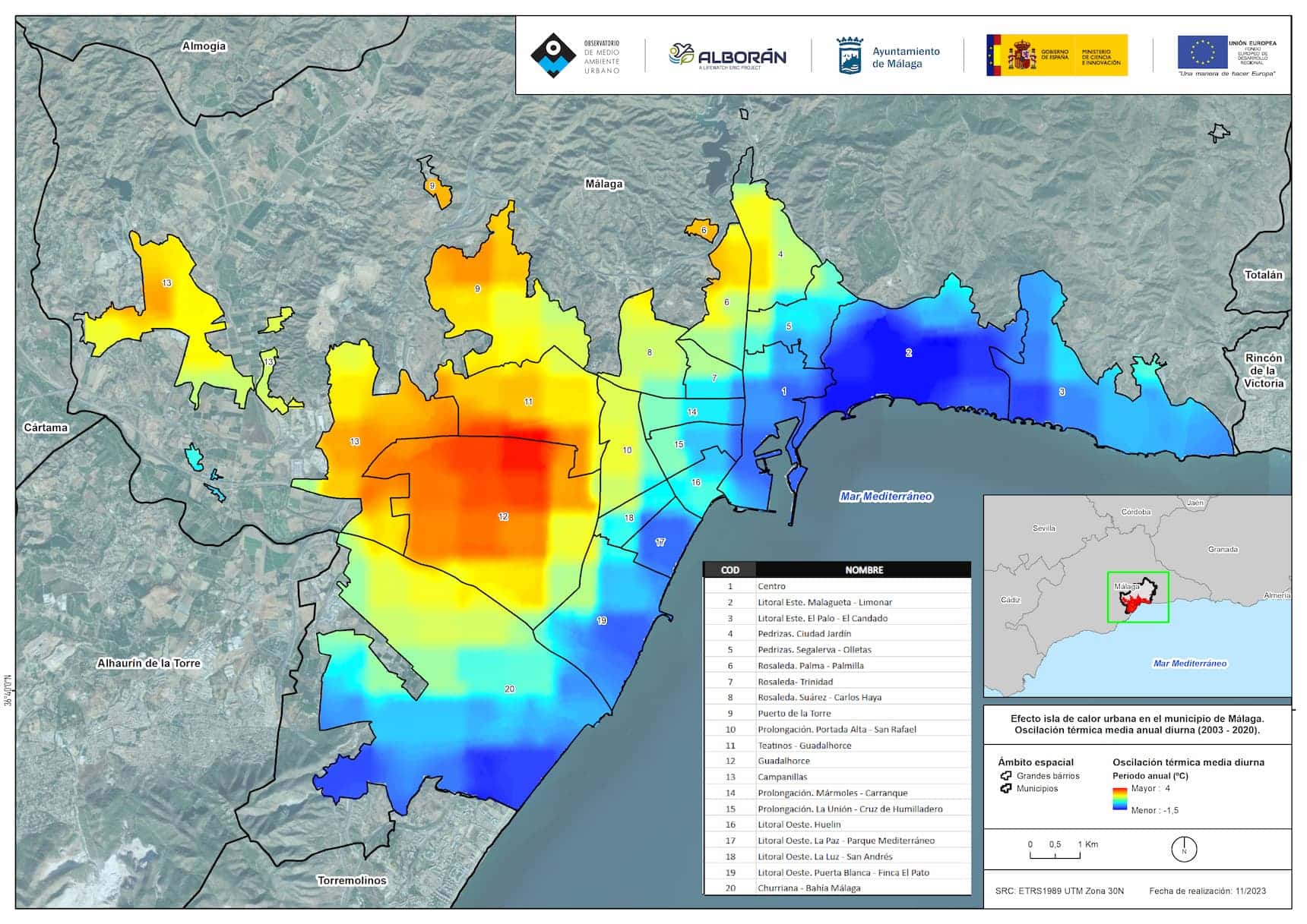
If you are reading this article, you may be interested in information about heat islands .
Advantages of using CO2 absorption maps
- Scientific Accuracy: Based on real data and scientific measurements.
- Effective Management: Allows strategic planning for conservation and reforestation.
- Environmental Awareness: Educate communities about the importance of carbon sinks.
- Contribution to Sustainability: Facilitates specific actions to reduce the carbon footprint.
Our success story [Lifewatch Alborán]
We share with you our project “ Preparation of CO2 absorption maps ” carried out in the province of Malaga, LifeWatch Alborán .
We embarked on a comprehensive mission to address key challenges and anticipate the sustainable future by incorporating Information and Communication Technologies (ICT). The main objectives include:
- Anticipate Environmental Impacts:
Anticipate effects of climate change, resource depletion and biodiversity loss. - Monitor GHG Absorption:
Closely monitor the absorption of greenhouse gases in urban environments to reduce CO2 emissions. - Contribute to Human Health:
Seek improvements in human health through sustainable strategies and healthier urban environments. - Promote R&D&I:
Generate research models to apply specific results in innovative projects. - Transfer Knowledge:
Share knowledge with managers, researchers, companies and citizens to inform policies and decisions that preserve biodiversity. - Evaluate Conservation Progress:
Use monitoring tools and measure KIPs to evaluate progress in the conservation of urban biodiversity and support the formulation of management and protection policies.
At agforest, we don’t just talk about sustainability, we put it into action.
If you want to know more about this project, click on the following link: https://agforest.ai/project/lifewatch-alboran
0 Comments